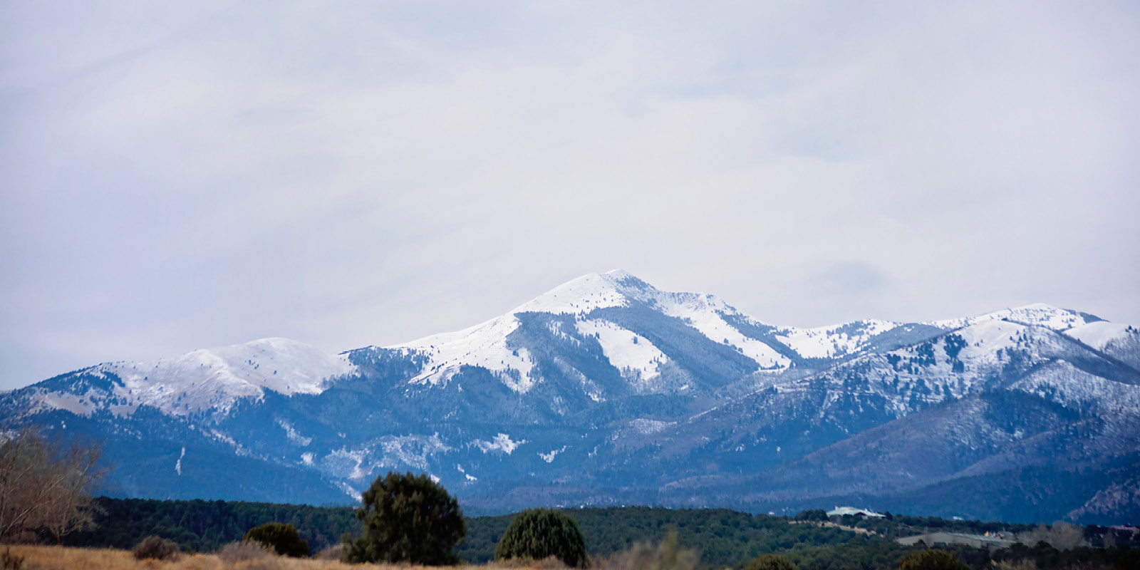


If you're into the hills, chills, and thrills plus relatively untapped bicycling trails and the incredible beauty of the Southern Rockies, then come to the Sacramento Mountains. Most trails are multi-use for hiking, mountain biking, and horseback riding.
The Grindstone Trail System was completed in 2014. The 18-mile multi-use trail system is open to hiking, biking, and equestrian usage.
Philadelphia, Kraut and Littleton Canyon
These three trails offer similarities, they all start out as old mining roads and turn into single-track trails, they're all up and then down, and they all peak out on Littleton Ridge. You're in the forest with the possibility of seeing all kinds of wildlife depending on season and time of day, maybe even find some gold.
Kraut Littleton: Go North on Hwy 48 about 10 Miles to the Hwy 37 intersection and go west to Bonito Lake. On the No. end of the Lake, Park and follow the Jeep Road approx. 1 mile to Anan Canyon; this is where your single track begins, turn north into the camp ground, and go over a burm on to the single track. If you lose the jeep road, go back ¼ mile look to your left for the camp ground and go north. The Kraut-Littleton loop is 7.95 miles with approx 1350 ft rise and descent.
- Route Location: Lincoln National Forest
- Surface: packed double track
- Distance: 5 miles (to the top and back down)
- Altitude Change: 500 to 600 feet
- Driving Time: 25 minutes from the intersection of Mechem & Sudderth
- Maps: Any good New Mexico road map or Lincoln National Forest map.
- To Reach: Take Hwy 48 towards Capitan turn onto Hwy 37 and follow for approximately 2 miles to the Bonito Lake turn-off, turn left and continue until you see the sign Philadelphia Canyon, park and start riding. The same directions apply to Kraut and Littleton, they're just further up the road.
Perk Canyon
Winding and climbing, this favorite of locals and tourists will enchant you. One minute you're in town and the next, you're deep in the forest. It climbs and jogs, crisscrosses a stream several times, zigs and zags, hooptidoos, and occasionally opens to beautiful meadows and if the rainfall is good, there's a pond.
- Route Location: Upper Canyon
- Surface: rocky single track
- Distance: 3 miles one way
- Difficulty: blue (intermediate)
- Altitude Change: 500 feet
- Driving time: 5 minutes from Mechem and Sudderth
- Maps: Ruidoso city map, or Smokey Bear Ranger Station can provide directions.
- Scenery: Beautiful forest views
- To Reach: On Sudderth Dr (Hwy48) go west into the Upper Canyon (Main St), turn right on Ebarb, go to Perk Canyon Dr, turn left approx.1 mile to the trail head. Perk Canyon is 1.9 miles to the top of Perk with approx. 586 ft. vertical rise.
Ski Apache
Ski Run Road to the Ski Apache Ski Resort. Summertime only. Take the gondola to the top and gear up for great mountain biking. Bike rentals available. Call 575-464-3600 in advance to reserve.
Spring Canyon
Directions: Go west on Sudderth (Hwy 48) to Mechem Dr., go North approx 1.5 mi to Cedar Creek Rd, turn west (left) & go approx 2.5 miles to Spring Canyon Rd; turn right, go 0.7 miles to the (T-13) Spring Canyon Trail Head. Spring Canyon is a 1.6 Mile trail when ridden to Ski Run Road with approx. 515 ft. vertical rise.
Big Bear Canyon
Directions: From the Kraut Littleton Parking area continue around Bonita Lake to the South Fork Campground turn. Park at the Blue Hole Pond ¼ mile from the turn into the campground; go west on the dirt road that will eventually turn into a single track that parallels the Forest Service road (on your right), and will go up to Runnels Riding Stables. At the Cattle Guard turn left (South) up into Big Bear until you see the Wilderness Boundary. At this point return to Blue Hole Pond as you rode in.
Spaghetti Bowl
Directions: Go west on Sudderth Dr (Hwy 48) to Mechem Dr, go North to Cedar Creek Rd, turn west (left), go 1/8 mile and turn right into the parking area; go northwest 50 yards until you find the trail.
Directions: Use the same directions you used to get to Spaghetti Bowl but go across Cedar Creek Rd to the Fitness Trail. On the southeast corner of the fitness trail you will see a gate go through the gate and turn left on the single track go about 100 yards to the service road; turn left go up to the gate and follow the road that eventually turns to the right. You are now on Fuel wood Road, the fuel wood gate is approx 1.5 miles away. 20 yards above the gate you can turn right and descend Slippery Elk back to the Spaghetti Bowl area. At 3 miles you will find a T-92 trail marker, at this point you can turn right and go to Raven to Cedar Creek Rd and go to Spring Canyon, or continue down Cedar Creek Rd to Upper Camp Unit 3 and enter the west end of the Spaghetti Bowl area. If you continue SW on the trail you will come to another T-92 marker turn right to continue to Perk Canyon or go straight to descend T-92 either will take you to the Perk Canyon Trail Head.
Buck Mountain / T-25
Directions: Take Highway 48 to Hwy 532 ( Ski Run Road ), go up to just past mile marker 11 at which point you will see The Buck Mountain Gate on the right side. PLEASE do not block access to the road if you park there; parking at Windy Point is suggested. Head out on Buck Mtn Road, you have a couple of options:
1) Go out and back to Buck Mtn Towers , 3.5 miles from the gate approx 780 ft vertical rise.
2) Turn right and go out to the Wilderness Boundary and return. PLEASE do not enter the wilderness on your bike.
3) Turn left on T-25 (1.65 Miles); drop to T-15 and into the Ski Area 1.25 miles 420 vertical feet. It is then approx. 1 mile back to the Buck Mtn. gate or 1.75 to Windy Point.
Buck Fort Stanton Area Trail
Directions: Take Hwy 48 approx 7 miles to Hwy 22; take Hwy 220 to Ft Stanton approx 13.75 miles to Ft Stanton, approx. 3 Miles past Ft Stanton. Look for the Parking Area/ Trail Head with Displayed Maps.
The Rim Trail
Located south of Ruidoso near Cloudcroft the Rim Trail boasts one of the the nation's premier paths. The 17 mile trail features spectacular views, bikers can see the White Sands from their two-wheelers during the first two miles of the ride along the rim. It's considered a top 10 trail in the nation.
- Route Location: Sacramento Mountains
- Surface: rocky and rooty single track
- Distance: 17 miles bullet Difficulty: blue (intermediate)
- Altitude Change: 100 to 300 feet several times
- Driving Time: one hour from the intersection of Mechem & Sudderth
- Maps: Any good New Mexico road map or Lincoln National Forest map.
- To Reach: Take Hwy 48 (Sudderth) to Hwy 70 west, travel approximately 10 miles to the Cloudcroft turn-off, Hwy 244. Travel approximate 30 miles to Cloudcroft and look for the sign to Sunspot, Hwy 130. Take 130 and look for Rim Trail signs.
Bonito Lake Road/ Bonito Area Map
Bonito Lake Road (Forest Road 107) provides easy mountain biking on some paved and gravel roads. The journey takes you through the forest, around the lake, and on towards the Wilderness trail heads. After turning on Hwy 37 continue approximately 1 1/2 miles to the turn-off to Bonito Lake Road. Follow the road up and around the lake, past Bonito Stables, and as far as the Argentina/Bonito Wilderness Trail heads. Mechanized equipment of any kind, including mountain bikes, is prohibited in the wilderness. You can park anywhere along the route and start and stop at your discretion.
- Route Location: Lincoln National Forest
- Surface: Asphalt and gravel forest road that varies between smooth & mildly rocky
- Distance: 20 miles (round trip)
- Difficulty: Easy (green)
- Altitude Change: 900 feet of rolling climb
- Driving Time: 20 minutes from the intersection of Mechem & Sudderth
- Maps: Any good New Mexico road map.
- To Reach: Take Hwy 48 towards Capitan, turn onto Hwy 37 and park
Other biking options in the area included La Luz Canyon, Pumphouse Canyon and the Silver Springs Loop for more information on trail status and directions the Cloudcroft Rangers Station can be reached at 575-682-2551.
 (1).jpg)